Pirep is a free, collaborative database of all public and private airports. All pilots are welcome to contribute their local knowledge to any airport, no registration required.


Public
Undocumented
METAR / TAF
Edit Tags
No upcoming events. Is anything happening here soon?
Airport Statistics
- General description
- Crew car availability
- Tags
Location:
Palm Springs, CA
Elevation:
-114ft
Sectional:
Los Angeles
Fuel:
100LL, A (prices)
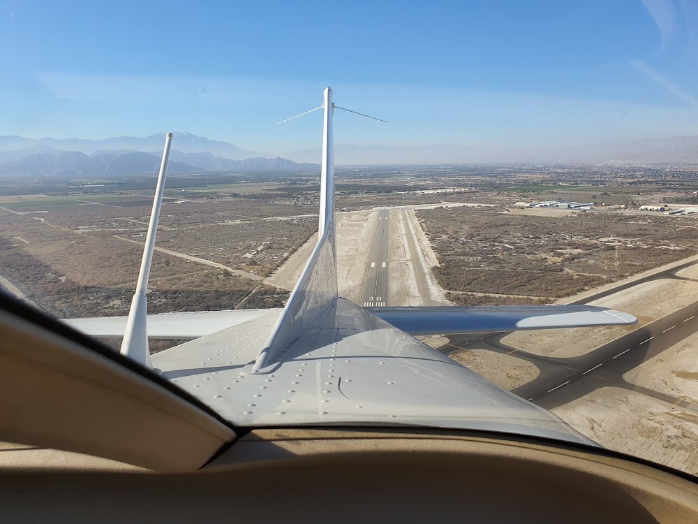
Runway 17/35:
8,500ft
Runway 12/30:
4,995ft
Access: Open to the public
Current Weather — VFR
-
Weather data is strictly informational and not for flight planning purposes.
-
METAR2026-07-21 05:52:00 PDT
Ceiling: Sky clear Wind: 320° @ 13kt, gusts 22kt Temperature: 91°F Dewpoint: 51°F Weather: N/A Visbility: 10SM Raw:METAR KTRM 211252Z AUTO 32013G22KT 10SM CLR 33/11 A2975 RMK AO2 PK WND 32026/1229 SLP078 T03280106 -
TAF2026-07-21 05:00:00 PDT – 2026-07-21 11:00:00 PDT
Ceiling: Sky clear Wind: Variable Weather: N/A Visbility: 6SM Clouds: @ ft Raw:TAF KTRM 211120Z 2112/2212 VRB05KT P6SM SKC FM211800 14007KT P6SM SKC FM220000 33015G23KT P6SM SKC FM220900 32010KT P6SM SKC -
TAF2026-07-21 11:00:00 PDT – 2026-07-21 17:00:00 PDT
Ceiling: Sky clear Wind: 140° @ 7kt Weather: N/A Visbility: 6SM Clouds: @ ft Raw:TAF KTRM 211120Z 2112/2212 VRB05KT P6SM SKC FM211800 14007KT P6SM SKC FM220000 33015G23KT P6SM SKC FM220900 32010KT P6SM SKC -
TAF2026-07-21 17:00:00 PDT – 2026-07-22 02:00:00 PDT
Ceiling: Sky clear Wind: 330° @ 15kt, gusts 23kt Weather: N/A Visbility: 6SM Clouds: @ ft Raw:TAF KTRM 211120Z 2112/2212 VRB05KT P6SM SKC FM211800 14007KT P6SM SKC FM220000 33015G23KT P6SM SKC FM220900 32010KT P6SM SKC -
TAF2026-07-22 02:00:00 PDT – 2026-07-22 05:00:00 PDT
Ceiling: Sky clear Wind: 320° @ 10kt Weather: N/A Visbility: 6SM Clouds: @ ft Raw:TAF KTRM 211120Z 2112/2212 VRB05KT P6SM SKC FM211800 14007KT P6SM SKC FM220000 33015G23KT P6SM SKC FM220900 32010KT P6SM SKC
Click/tap to add an annotation marker to the map
No webcams added yet.
Remarks
- Soft gnd off rwy pavement.
- For cd ctc socal apch at 800-448-3724.
- Actvt reil rwys 17 & 35; papi rwys 12, 17, 30 & 35; mirl rwys 12/30 & 17/35 - ctaf.
- 200 ft blast pads both ends.
- Unusbl byd 8 nm due to terrain.
Comments