Pirep is a free, collaborative database of all public and private airports. All pilots are welcome to contribute their local knowledge to any airport, no registration required.
No upcoming events. Is anything happening here soon?
Airport Statistics
- Fuel pump location
- Airport photos
- Landing & tie-down fees
Location:
Decatur, TX
Elevation:
883ft
Sectional:
Dallas Ft Worth
Activation date:
Nov 1990
Fuel:
None
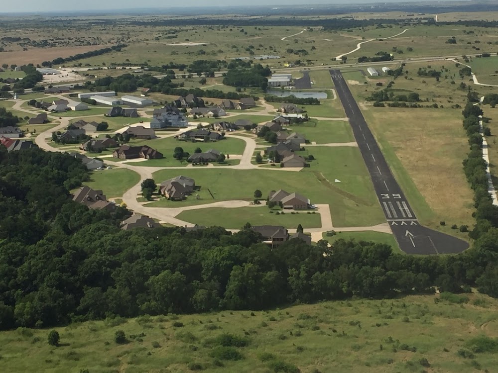
Runway 13/31:
3,000ft
Access: Open to the public
This airport is privately owned but open to the public.
Similar Airports

Click/tap to add an annotation marker to the map
No webcams added yet.
Remarks
- Deer & birds on and invof arpt.
- All acft monitor ctaf due to the close proximity to rhome meadows arpt t76.
- Parachute activity invof arpt.
- Rco ctl model acft ops on arpt.
- For cd ctc lone star apch at 972-615-2799.
- Days: rwy defined by white "l" markers on each corner - nights: two lights each side of cntrln mark rwy ends.
- Actvt lirl rwy 13/31 - ctaf.
- Right tfc for fixed wing acft; remain east of the rwy.
Comments