Pirep is a free, collaborative database of all public and private airports. All pilots are welcome to contribute their local knowledge to any airport, no registration required.
No upcoming events. Is anything happening here soon?
Last updated: 2023-05-24 22:37:15 EDT
Airport Statistics
- Crew car availability
- Landing & tie-down fees
- Transient parking location
Location:
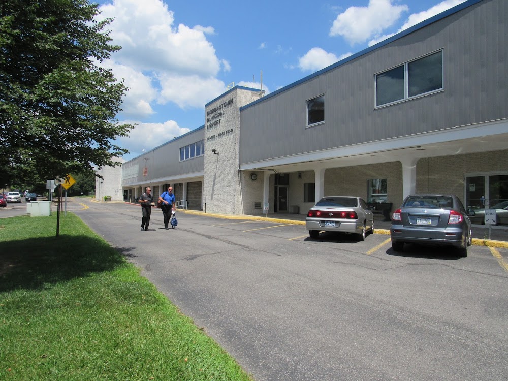
Morgantown, WV
Elevation:
1,243ft
Sectional:
Cincinnati
Activation date:
Jun 1938
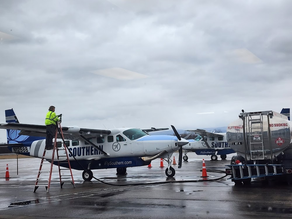
Fuel:
100LL, A, A+ (prices)
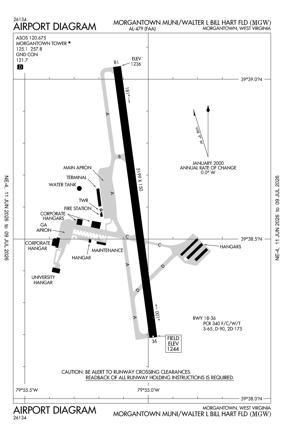
Runway 18/36:
5,199ft
Access: Open to the public
Similar Airports
Current Weather — MVFR
-
Weather data is strictly informational and not for flight planning purposes.
-
METAR2026-07-21 09:53:00 EDT
Ceiling: 1,200ft Wind: 220° @ 7kt, gusts 15kt Temperature: 75°F Dewpoint: 71°F Weather: N/A Visbility: 10SM Clouds: Overcast @ 1,200ft Raw:METAR KMGW 211353Z 22007G15KT 10SM OVC012 24/22 A2986 RMK AO2 SLP099 T02440222 -
TAF2026-07-21 09:00:00 EDT – 2026-07-21 12:00:00 EDT
Ceiling: 1,500ft Wind: 210° @ 7kt Weather: N/A Visbility: 6SM Clouds: Broken @ 1,500ft, Broken @ 6,000ft Raw:TAF KMGW 211243Z 2113/2212 21007KT P6SM BKN015 BKN060 TEMPO 2114/2116 6SM -TSRA OVC025CB FM211600 23009G18KT 4SM -TSRA BKN028CB FM212100 21010G22KT 3SM BR BKN018 PROB30 2121/2124 TSRA OVC025CB FM220000 22009G20KT 5SM -SHRA BKN018 FM220200 22007KT P6SM BKN025 PROB30 2202/2206 6SM -TSRA OVC020CB FM220600 VRB04KT P6SM FEW012 SCT045 -
TAF2026-07-21 10:00:00 EDT – 2026-07-21 12:00:00 EDT
Ceiling: 2,500ft Wind: 000° @ kt Weather: Light thunderstorm rain Visbility: 6SM Clouds: Overcast @ 2,500ft Raw:TAF KMGW 211243Z 2113/2212 21007KT P6SM BKN015 BKN060 TEMPO 2114/2116 6SM -TSRA OVC025CB FM211600 23009G18KT 4SM -TSRA BKN028CB FM212100 21010G22KT 3SM BR BKN018 PROB30 2121/2124 TSRA OVC025CB FM220000 22009G20KT 5SM -SHRA BKN018 FM220200 22007KT P6SM BKN025 PROB30 2202/2206 6SM -TSRA OVC020CB FM220600 VRB04KT P6SM FEW012 SCT045 -
TAF2026-07-21 12:00:00 EDT – 2026-07-21 17:00:00 EDT
Ceiling: 2,800ft Wind: 230° @ 9kt, gusts 18kt Weather: Light thunderstorm rain Visbility: 4SM Clouds: Broken @ 2,800ft Raw:TAF KMGW 211243Z 2113/2212 21007KT P6SM BKN015 BKN060 TEMPO 2114/2116 6SM -TSRA OVC025CB FM211600 23009G18KT 4SM -TSRA BKN028CB FM212100 21010G22KT 3SM BR BKN018 PROB30 2121/2124 TSRA OVC025CB FM220000 22009G20KT 5SM -SHRA BKN018 FM220200 22007KT P6SM BKN025 PROB30 2202/2206 6SM -TSRA OVC020CB FM220600 VRB04KT P6SM FEW012 SCT045 -
TAF2026-07-21 17:00:00 EDT – 2026-07-21 20:00:00 EDT
Ceiling: 1,800ft Wind: 210° @ 10kt, gusts 22kt Weather: Mist Visbility: 3SM Clouds: Broken @ 1,800ft Raw:TAF KMGW 211243Z 2113/2212 21007KT P6SM BKN015 BKN060 TEMPO 2114/2116 6SM -TSRA OVC025CB FM211600 23009G18KT 4SM -TSRA BKN028CB FM212100 21010G22KT 3SM BR BKN018 PROB30 2121/2124 TSRA OVC025CB FM220000 22009G20KT 5SM -SHRA BKN018 FM220200 22007KT P6SM BKN025 PROB30 2202/2206 6SM -TSRA OVC020CB FM220600 VRB04KT P6SM FEW012 SCT045 -
TAF2026-07-21 17:00:00 EDT – 2026-07-21 20:00:00 EDT
Ceiling: 2,500ft Wind: 000° @ kt Weather: Thunderstorm rain Visbility: SM Clouds: Overcast @ 2,500ft Raw:TAF KMGW 211243Z 2113/2212 21007KT P6SM BKN015 BKN060 TEMPO 2114/2116 6SM -TSRA OVC025CB FM211600 23009G18KT 4SM -TSRA BKN028CB FM212100 21010G22KT 3SM BR BKN018 PROB30 2121/2124 TSRA OVC025CB FM220000 22009G20KT 5SM -SHRA BKN018 FM220200 22007KT P6SM BKN025 PROB30 2202/2206 6SM -TSRA OVC020CB FM220600 VRB04KT P6SM FEW012 SCT045 -
TAF2026-07-21 20:00:00 EDT – 2026-07-21 22:00:00 EDT
Ceiling: 1,800ft Wind: 220° @ 9kt, gusts 20kt Weather: Light rain showers Visbility: 5SM Clouds: Broken @ 1,800ft Raw:TAF KMGW 211243Z 2113/2212 21007KT P6SM BKN015 BKN060 TEMPO 2114/2116 6SM -TSRA OVC025CB FM211600 23009G18KT 4SM -TSRA BKN028CB FM212100 21010G22KT 3SM BR BKN018 PROB30 2121/2124 TSRA OVC025CB FM220000 22009G20KT 5SM -SHRA BKN018 FM220200 22007KT P6SM BKN025 PROB30 2202/2206 6SM -TSRA OVC020CB FM220600 VRB04KT P6SM FEW012 SCT045 -
TAF2026-07-21 22:00:00 EDT – 2026-07-22 02:00:00 EDT
Ceiling: 2,000ft Wind: 000° @ kt Weather: Light thunderstorm rain Visbility: 6SM Clouds: Overcast @ 2,000ft Raw:TAF KMGW 211243Z 2113/2212 21007KT P6SM BKN015 BKN060 TEMPO 2114/2116 6SM -TSRA OVC025CB FM211600 23009G18KT 4SM -TSRA BKN028CB FM212100 21010G22KT 3SM BR BKN018 PROB30 2121/2124 TSRA OVC025CB FM220000 22009G20KT 5SM -SHRA BKN018 FM220200 22007KT P6SM BKN025 PROB30 2202/2206 6SM -TSRA OVC020CB FM220600 VRB04KT P6SM FEW012 SCT045 -
TAF2026-07-21 22:00:00 EDT – 2026-07-22 02:00:00 EDT
Ceiling: 2,500ft Wind: 220° @ 7kt Weather: N/A Visbility: 6SM Clouds: Broken @ 2,500ft Raw:TAF KMGW 211243Z 2113/2212 21007KT P6SM BKN015 BKN060 TEMPO 2114/2116 6SM -TSRA OVC025CB FM211600 23009G18KT 4SM -TSRA BKN028CB FM212100 21010G22KT 3SM BR BKN018 PROB30 2121/2124 TSRA OVC025CB FM220000 22009G20KT 5SM -SHRA BKN018 FM220200 22007KT P6SM BKN025 PROB30 2202/2206 6SM -TSRA OVC020CB FM220600 VRB04KT P6SM FEW012 SCT045 -
TAF2026-07-22 02:00:00 EDT – 2026-07-22 08:00:00 EDT
Ceiling: Sky clear Wind: Variable Weather: N/A Visbility: 6SM Clouds: Few @ 1,200ft, Scattered @ 4,500ft Raw:TAF KMGW 211243Z 2113/2212 21007KT P6SM BKN015 BKN060 TEMPO 2114/2116 6SM -TSRA OVC025CB FM211600 23009G18KT 4SM -TSRA BKN028CB FM212100 21010G22KT 3SM BR BKN018 PROB30 2121/2124 TSRA OVC025CB FM220000 22009G20KT 5SM -SHRA BKN018 FM220200 22007KT P6SM BKN025 PROB30 2202/2206 6SM -TSRA OVC020CB FM220600 VRB04KT P6SM FEW012 SCT045
Click/tap to add an annotation marker to the map
No webcams added yet.
Remarks
- Ppr 24 hrs for unscheduled acr opns, call amgr 304-291-7461.
- Deer & birds on & invof arpt.
- Fbo hrs mon-fri 0500-0000, sat-sun 0500-2300. 24-hr phone nr 304-296-2359.
- Be alert: possibility of turbulence invof power plant stacks 3.6 miles n of afld durg cold weather.
- For cd ctc clarksburg apch at 304-842-2011, when apch clsd ctc cleveland artcc at 440-774-0226.
Comments