Pirep is a free, collaborative database of all public and private airports. All pilots are welcome to contribute their local knowledge to any airport, no registration required.


No upcoming events. Is anything happening here soon?
Last updated: 2023-05-24 22:22:24 EDT
Airport Statistics
- Landing & tie-down fees
- Airport photos
- Transient parking location
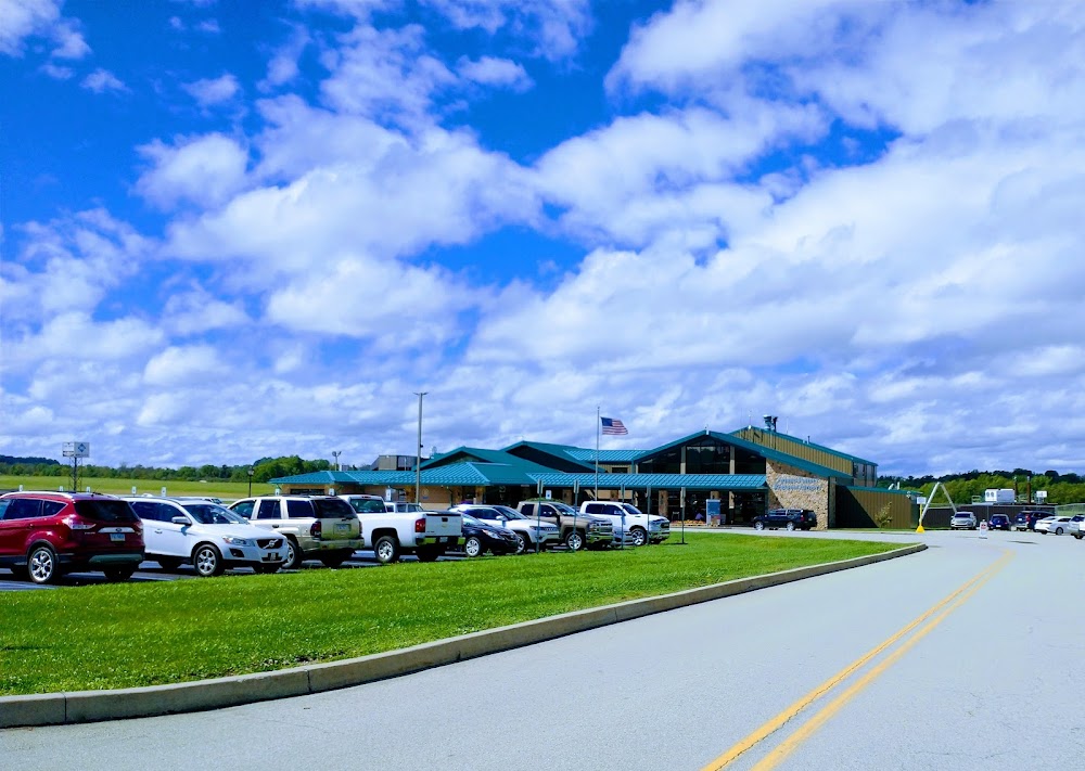
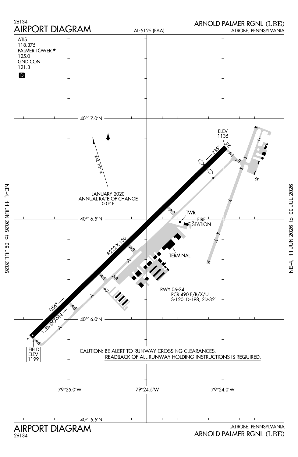
Location:
Latrobe, PA
Elevation:
1,198ft
Sectional:
Detroit
Activation date:
Apr 1938
Fuel:
100LL, A (prices)
Runway 06/24:
8,222ft
Access: Open to the public
Similar Airports

Current Weather — MVFR
-
Weather data is strictly informational and not for flight planning purposes.
-
METAR2026-07-29 03:15:00 EDT
Ceiling: 2,800ft Wind: Calm Temperature: 68°F Dewpoint: 66°F Weather: N/A Visbility: 9SM Clouds: Scattered @ 2,000ft, Overcast @ 2,800ft Raw:METAR KLBE 290715Z AUTO 00000KT 9SM SCT020 OVC028 20/19 A2976 RMK AO2 -
TAF2026-07-29 03:00:00 EDT – 2026-07-29 07:00:00 EDT
Ceiling: 1,500ft Wind: 000° @ kt Weather: N/A Visbility: SM Clouds: Broken @ 1,500ft Raw:TAF KLBE 290658Z 2907/3006 VRB03KT P6SM SCT025 BKN040 TEMPO 2907/2911 BKN015 FM291400 29010KT P6SM BKN035 FM291800 31010G18KT P6SM BKN040 FM300100 30003KT P6SM SKC -
TAF2026-07-29 03:00:00 EDT – 2026-07-29 10:00:00 EDT
Ceiling: 4,000ft Wind: Variable Weather: N/A Visbility: 6SM Clouds: Scattered @ 2,500ft, Broken @ 4,000ft Raw:TAF KLBE 290658Z 2907/3006 VRB03KT P6SM SCT025 BKN040 TEMPO 2907/2911 BKN015 FM291400 29010KT P6SM BKN035 FM291800 31010G18KT P6SM BKN040 FM300100 30003KT P6SM SKC -
TAF2026-07-29 10:00:00 EDT – 2026-07-29 14:00:00 EDT
Ceiling: 3,500ft Wind: 290° @ 10kt Weather: N/A Visbility: 6SM Clouds: Broken @ 3,500ft Raw:TAF KLBE 290658Z 2907/3006 VRB03KT P6SM SCT025 BKN040 TEMPO 2907/2911 BKN015 FM291400 29010KT P6SM BKN035 FM291800 31010G18KT P6SM BKN040 FM300100 30003KT P6SM SKC -
TAF2026-07-29 14:00:00 EDT – 2026-07-29 21:00:00 EDT
Ceiling: 4,000ft Wind: 310° @ 10kt, gusts 18kt Weather: N/A Visbility: 6SM Clouds: Broken @ 4,000ft Raw:TAF KLBE 290658Z 2907/3006 VRB03KT P6SM SCT025 BKN040 TEMPO 2907/2911 BKN015 FM291400 29010KT P6SM BKN035 FM291800 31010G18KT P6SM BKN040 FM300100 30003KT P6SM SKC -
TAF2026-07-29 21:00:00 EDT – 2026-07-30 02:00:00 EDT
Ceiling: Sky clear Wind: 300° @ 3kt Weather: N/A Visbility: 6SM Clouds: @ ft Raw:TAF KLBE 290658Z 2907/3006 VRB03KT P6SM SCT025 BKN040 TEMPO 2907/2911 BKN015 FM291400 29010KT P6SM BKN035 FM291800 31010G18KT P6SM BKN040 FM300100 30003KT P6SM SKC
Click/tap to add an annotation marker to the map
No webcams added yet.
Remarks
- Ppr 24 for unsked acft ops with more than 9 pax call amgr 724-640-7234.
- Deer & birds on & invof arpt.
- For cd when atct clsd ctc johnstown apch at 814-532-5960, when apch clsd ctc cleveland artcc at 440-774-0213.
- When atct clsd, actvt malsr rwy 24; reil rwy 06; hirl rwy 06/24; twy a, b, c & d - ctaf.
- Rwy 24 papi unusbl byd 8 degs right of cntrln.
Comments