Pirep is a free, collaborative database of all public and private airports. All pilots are welcome to contribute their local knowledge to any airport, no registration required.
Airport Statistics
- Local flying clubs
- Landing & tie-down fees
- Webcam links
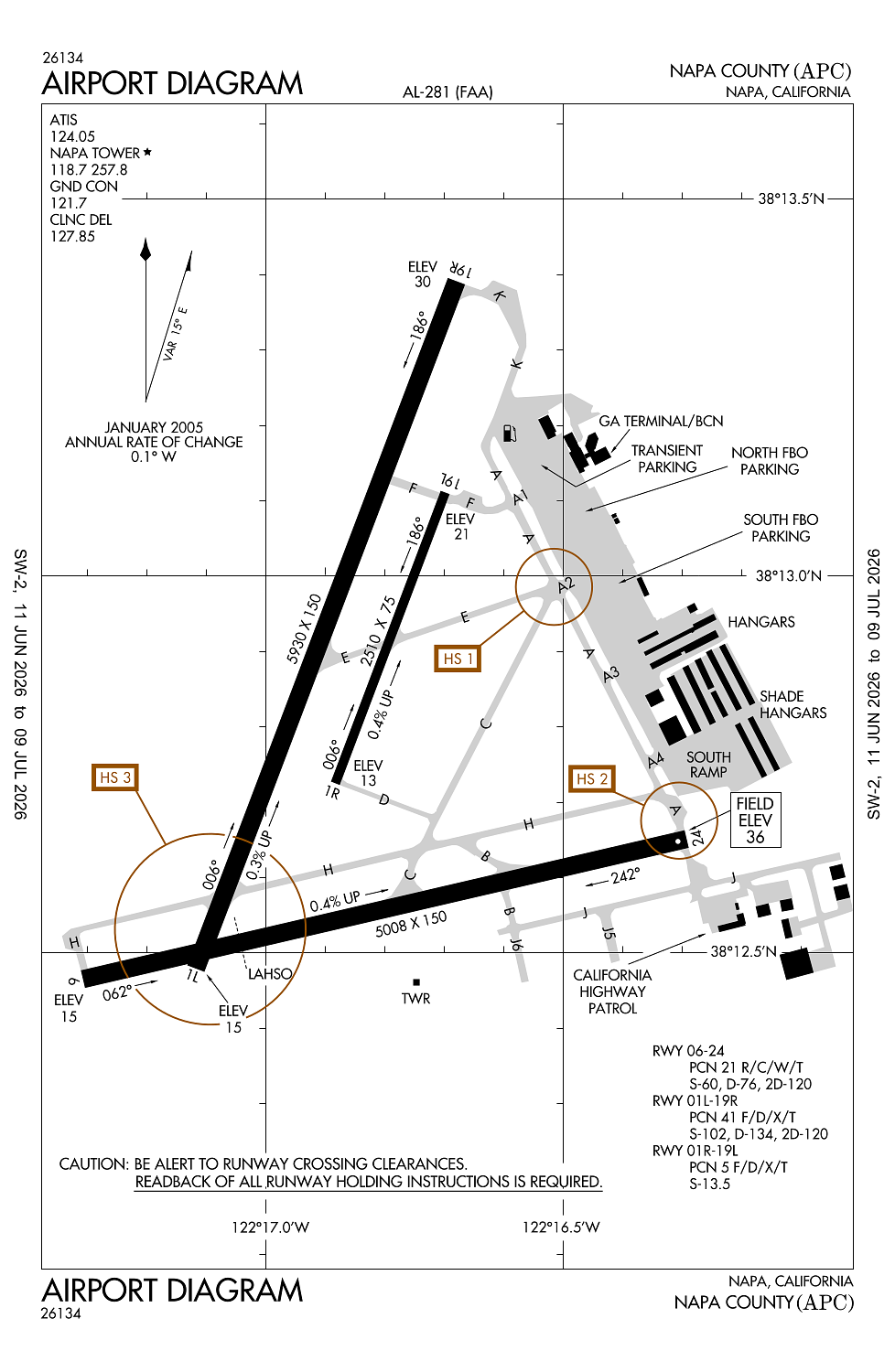
Location:
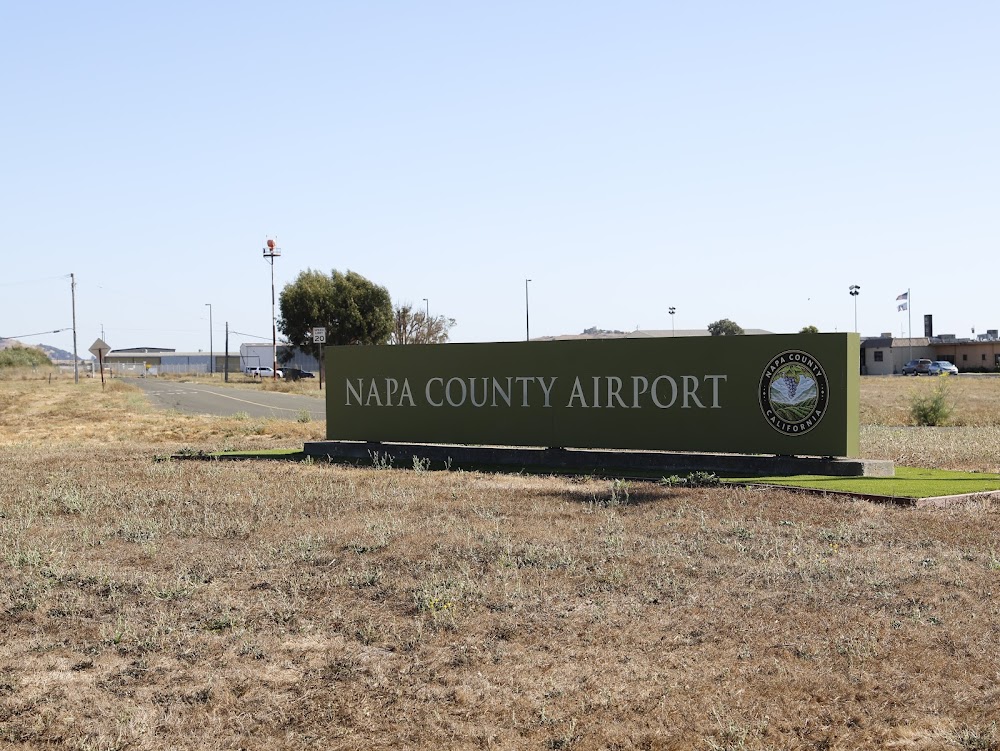
Napa, CA
Elevation:
35ft
Sectional:
San Francisco
Activation date:
Oct 1944
Fuel:
100LL, A (prices)
Runway 01L/19R:
5,930ft
Runway 06/24:
5,008ft
Runway 01R/19L:
2,510ft
Access: Open to the public
Similar Airports

Current Weather — VFR
-
Weather data is strictly informational and not for flight planning purposes.
-
METAR2026-07-16 03:54:00 PDT
Ceiling: Sky clear Wind: 230° @ 7kt Temperature: 57°F Dewpoint: 50°F Weather: N/A Visbility: 10SM Raw:METAR KAPC 161054Z AUTO 23007KT 10SM CLR 14/10 A2988 RMK AO2 SLP109 T01390100 -
TAF2026-07-16 05:00:00 PDT – 2026-07-16 11:00:00 PDT
Ceiling: Sky clear Wind: 220° @ 8kt Weather: N/A Visbility: 6SM Clouds: @ ft Raw:TAF KAPC 161120Z 1612/1712 22008KT P6SM SKC FM161800 22013KT P6SM SKC FM170600 22008KT P6SM SCT007 FM170900 22006KT P6SM BKN007 -
TAF2026-07-16 11:00:00 PDT – 2026-07-16 23:00:00 PDT
Ceiling: Sky clear Wind: 220° @ 13kt Weather: N/A Visbility: 6SM Clouds: @ ft Raw:TAF KAPC 161120Z 1612/1712 22008KT P6SM SKC FM161800 22013KT P6SM SKC FM170600 22008KT P6SM SCT007 FM170900 22006KT P6SM BKN007 -
TAF2026-07-16 23:00:00 PDT – 2026-07-17 02:00:00 PDT
Ceiling: Sky clear Wind: 220° @ 8kt Weather: N/A Visbility: 6SM Clouds: Scattered @ 700ft Raw:TAF KAPC 161120Z 1612/1712 22008KT P6SM SKC FM161800 22013KT P6SM SKC FM170600 22008KT P6SM SCT007 FM170900 22006KT P6SM BKN007 -
TAF2026-07-17 02:00:00 PDT – 2026-07-17 05:00:00 PDT
Ceiling: 700ft Wind: 220° @ 6kt Weather: N/A Visbility: 6SM Clouds: Broken @ 700ft Raw:TAF KAPC 161120Z 1612/1712 22008KT P6SM SKC FM161800 22013KT P6SM SKC FM170600 22008KT P6SM SCT007 FM170900 22006KT P6SM BKN007
Click/tap to add an annotation marker to the map
No webcams added yet.
Remarks
- Asph twys strength 30,000 gwt single wheel.
- Asph aprons strength 12500-30000 lbs gwt single wheel.
- Unlgtd bridge 1 nm s, 167 ft agl
- Due to airport proximity to wetlands birds on and invof the airport year around with highest concentration of activity of birds on the rys during rainy weather.
- For cd when atct clsd ctc oakland artcc at 510-745-3380.
Comments