Pirep is a free, collaborative database of all public and private airports. All pilots are welcome to contribute their local knowledge to any airport, no registration required.


No upcoming events. Is anything happening here soon?
Last updated: 2023-05-25 03:05:01 EDT
Last updated: 2023-04-14 16:26:28 EDT
Airport Statistics
- Local flying clubs
- Fuel pump location
- Transient parking location
Location:
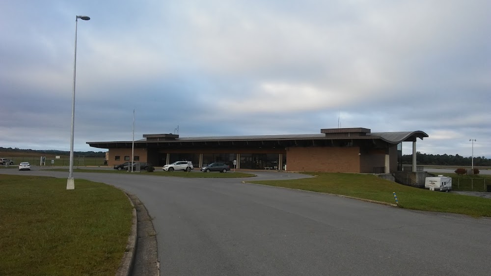
Beckley, WV
Elevation:
2,503ft
Sectional:
Cincinnati
Activation date:
Sep 1952
Fuel:
100LL, A (prices)
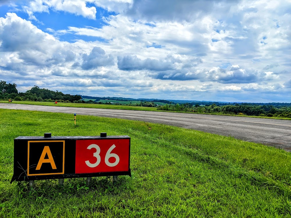
Runway 01/19:
6,750ft
Runway 10/28:
5,001ft
Access: Open to the public
Similar Airports

Current Weather — IFR
-
Weather data is strictly informational and not for flight planning purposes.
-
METAR2026-07-25 08:10:00 EDT
Ceiling: 700ft Wind: Calm Temperature: 69°F Dewpoint: 62°F Weather: N/A Visbility: 10SM Clouds: Broken @ 700ft Raw:SPECI KBKW 251210Z AUTO 00000KT 10SM BKN007 21/17 A3016 RMK AO1 T02060172 $ -
TAF2026-07-25 08:00:00 EDT – 2026-07-25 09:30:00 EDT
Ceiling: 900ft Wind: 150° @ 4kt Weather: N/A Visbility: 6SM Clouds: Broken @ 900ft Raw:TAF KBKW 251220Z 2512/2612 15004KT P6SM BKN009 FM251330 VRB03KT P6SM SCT014 BKN030 FM251500 28004KT P6SM SCT035 BKN090 FM251900 29007KT P6SM SCT045 FM260200 00000KT P6SM SCT130 -
TAF2026-07-25 09:30:00 EDT – 2026-07-25 11:00:00 EDT
Ceiling: 3,000ft Wind: Variable Weather: N/A Visbility: 6SM Clouds: Scattered @ 1,400ft, Broken @ 3,000ft Raw:TAF KBKW 251220Z 2512/2612 15004KT P6SM BKN009 FM251330 VRB03KT P6SM SCT014 BKN030 FM251500 28004KT P6SM SCT035 BKN090 FM251900 29007KT P6SM SCT045 FM260200 00000KT P6SM SCT130 -
TAF2026-07-25 11:00:00 EDT – 2026-07-25 15:00:00 EDT
Ceiling: 9,000ft Wind: 280° @ 4kt Weather: N/A Visbility: 6SM Clouds: Scattered @ 3,500ft, Broken @ 9,000ft Raw:TAF KBKW 251220Z 2512/2612 15004KT P6SM BKN009 FM251330 VRB03KT P6SM SCT014 BKN030 FM251500 28004KT P6SM SCT035 BKN090 FM251900 29007KT P6SM SCT045 FM260200 00000KT P6SM SCT130 -
TAF2026-07-25 15:00:00 EDT – 2026-07-25 22:00:00 EDT
Ceiling: Sky clear Wind: 290° @ 7kt Weather: N/A Visbility: 6SM Clouds: Scattered @ 4,500ft Raw:TAF KBKW 251220Z 2512/2612 15004KT P6SM BKN009 FM251330 VRB03KT P6SM SCT014 BKN030 FM251500 28004KT P6SM SCT035 BKN090 FM251900 29007KT P6SM SCT045 FM260200 00000KT P6SM SCT130 -
TAF2026-07-25 22:00:00 EDT – 2026-07-26 08:00:00 EDT
Ceiling: Sky clear Wind: Calm Weather: N/A Visbility: 6SM Clouds: Scattered @ 13,000ft Raw:TAF KBKW 251220Z 2512/2612 15004KT P6SM BKN009 FM251330 VRB03KT P6SM SCT014 BKN030 FM251500 28004KT P6SM SCT035 BKN090 FM251900 29007KT P6SM SCT045 FM260200 00000KT P6SM SCT130
Click/tap to add an annotation marker to the map
No webcams added yet.
Remarks
- This airport has been surveyed by the national geodetic survey.
- Estab prior to 1959.
- Ppr 24 hrs for unsked acr opns with more than 30 psgr seats; call amgr 304-255-0476. index b coverage is prvdd.
- Deer; birds & wild turkeys on & invof arpt.
- Actvt malsr rwy 19; reil rwy 01, 10 & 28; vasi rwy 10 & 28; mirl rwy 10/28; hirl rwy 01/19; twy lgts - ctaf. papi rwy 01 & 19 set at medium, ctc unicom to change intst.
- 9 ft obstn lgtd pole, 125 ft fm aer, 250 ft r.
- All sfcs work in prog, grass cutting apr thru oct.
- Pcr value: 740/f/b/x/t
Comments