Pirep is a free, collaborative database of all public and private airports. All pilots are welcome to contribute their local knowledge to any airport, no registration required.

Upcoming Events
-
Sat, Oct 10 2026 10:00am – 11:00am
-
Fri, Oct 9 2026 7:00pm – 8:00pm
-
Fri, Nov 13 2026 7:00pm – 8:00pm
-
Sat, Nov 14 2026 10:00am – 11:00am
-
Fri, Dec 11 2026 7:00pm – 8:00pm
-
Fri, Aug 14 2026 7:00pm – 8:00pm
-
Sat, Aug 8 2026 10:00am – 11:00am
-
Fri, Sep 11 2026 7:00pm – 8:00pm
-
Sat, Sep 12 2026 10:00am – 11:00am
-
Sat, Jan 9 2027 10:00am – 11:00am
-
Fri, Jan 15 2027 7:00pm – 8:00pm
-
Fri, Feb 12 2027 7:00pm – 8:00pm
-
Sat, Feb 13 2027 10:00am – 11:00am
Last updated: 2023-05-29 21:39:49 CDT
Last updated: 2024-02-04 16:13:48 CST
Airport Statistics
- Landing & tie-down fees
- Webcam links
- Fuel pump location
Location:
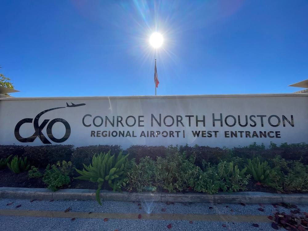
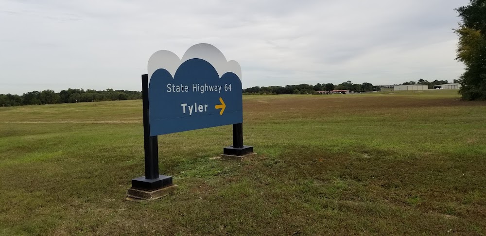
Houston, TX
Elevation:
244ft
Sectional:
Houston
Activation date:
May 1944
Fuel:
100LL, A (prices)
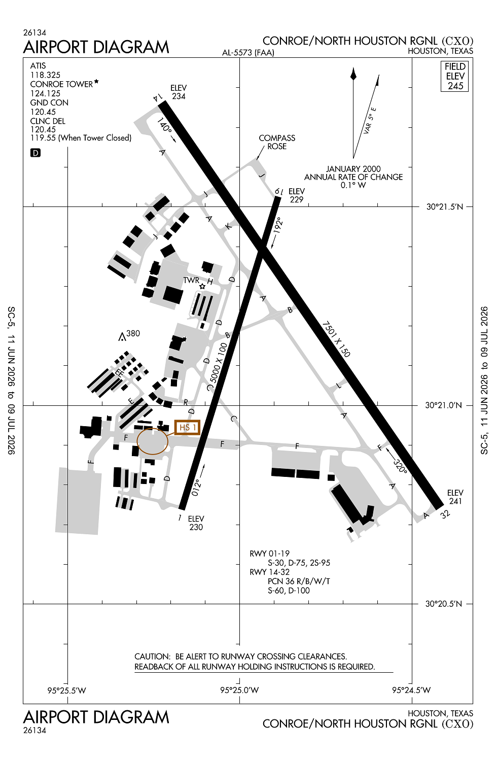
Runway 14/32:
7,501ft
Runway 01/19:
5,000ft
Access: Open to the public
Similar Airports


Current Weather — VFR
-
Weather data is strictly informational and not for flight planning purposes.
-
METAR2026-07-15 20:53:00 CDT
Ceiling: Sky clear Wind: 070° @ 4kt Temperature: 78°F Dewpoint: 73°F Weather: N/A Visbility: 10SM Raw:METAR KCXO 160153Z AUTO 07004KT 10SM CLR 26/23 A3005 RMK AO2 SLP172 T02560228 -
TAF2026-07-15 19:00:00 CDT – 2026-07-16 10:00:00 CDT
Ceiling: Sky clear Wind: Variable Weather: N/A Visbility: 6SM Clouds: Few @ 2,500ft, Few @ 12,000ft Raw:TAF KCXO 152338Z 1600/1624 VRB03KT P6SM FEW025 FEW120 TEMPO 1610/1614 6SM BR BKN015 BKN025 FM161500 17007KT P6SM SCT025 BKN035 FM161800 18007KT P6SM SCT050 BKN100 PROB30 1618/1622 VRB10G20KT 5SM -TSRA SCT035CB BKN050 -
TAF2026-07-16 05:00:00 CDT – 2026-07-16 09:00:00 CDT
Ceiling: 1,500ft Wind: 000° @ kt Weather: Mist Visbility: 6SM Clouds: Broken @ 1,500ft, Broken @ 2,500ft Raw:TAF KCXO 152338Z 1600/1624 VRB03KT P6SM FEW025 FEW120 TEMPO 1610/1614 6SM BR BKN015 BKN025 FM161500 17007KT P6SM SCT025 BKN035 FM161800 18007KT P6SM SCT050 BKN100 PROB30 1618/1622 VRB10G20KT 5SM -TSRA SCT035CB BKN050 -
TAF2026-07-16 10:00:00 CDT – 2026-07-16 13:00:00 CDT
Ceiling: 3,500ft Wind: 170° @ 7kt Weather: N/A Visbility: 6SM Clouds: Scattered @ 2,500ft, Broken @ 3,500ft Raw:TAF KCXO 152338Z 1600/1624 VRB03KT P6SM FEW025 FEW120 TEMPO 1610/1614 6SM BR BKN015 BKN025 FM161500 17007KT P6SM SCT025 BKN035 FM161800 18007KT P6SM SCT050 BKN100 PROB30 1618/1622 VRB10G20KT 5SM -TSRA SCT035CB BKN050 -
TAF2026-07-16 13:00:00 CDT – 2026-07-16 19:00:00 CDT
Ceiling: 10,000ft Wind: 180° @ 7kt Weather: N/A Visbility: 6SM Clouds: Scattered @ 5,000ft, Broken @ 10,000ft Raw:TAF KCXO 152338Z 1600/1624 VRB03KT P6SM FEW025 FEW120 TEMPO 1610/1614 6SM BR BKN015 BKN025 FM161500 17007KT P6SM SCT025 BKN035 FM161800 18007KT P6SM SCT050 BKN100 PROB30 1618/1622 VRB10G20KT 5SM -TSRA SCT035CB BKN050 -
TAF2026-07-16 13:00:00 CDT – 2026-07-16 17:00:00 CDT
Ceiling: 5,000ft Wind: Variable, gusts 20kt Weather: Light thunderstorm rain Visbility: 5SM Clouds: Scattered @ 3,500ft, Broken @ 5,000ft Raw:TAF KCXO 152338Z 1600/1624 VRB03KT P6SM FEW025 FEW120 TEMPO 1610/1614 6SM BR BKN015 BKN025 FM161500 17007KT P6SM SCT025 BKN035 FM161800 18007KT P6SM SCT050 BKN100 PROB30 1618/1622 VRB10G20KT 5SM -TSRA SCT035CB BKN050
Click/tap to add an annotation marker to the map
No webcams added yet.
Remarks
- Extsv mil hel actvty on arpt.
- (a23) hels use right tfc.
- Avoid noise sensitive area 10 mi sw quad of arpt.
- Military: fuel 1200-0300z++, c936-494-4252.
- For cd when atct clsd ctc houston apch at 281-443-5844, to cnl ifr at 281-443-5888.
Comments