Pirep is a free, collaborative database of all public and private airports. All pilots are welcome to contribute their local knowledge to any airport, no registration required.


No upcoming events. Is anything happening here soon?
Last updated: 2024-02-15 00:31:23 CST
Airport Statistics
- Fuel pump location
- Crew car availability
- WiFi availability
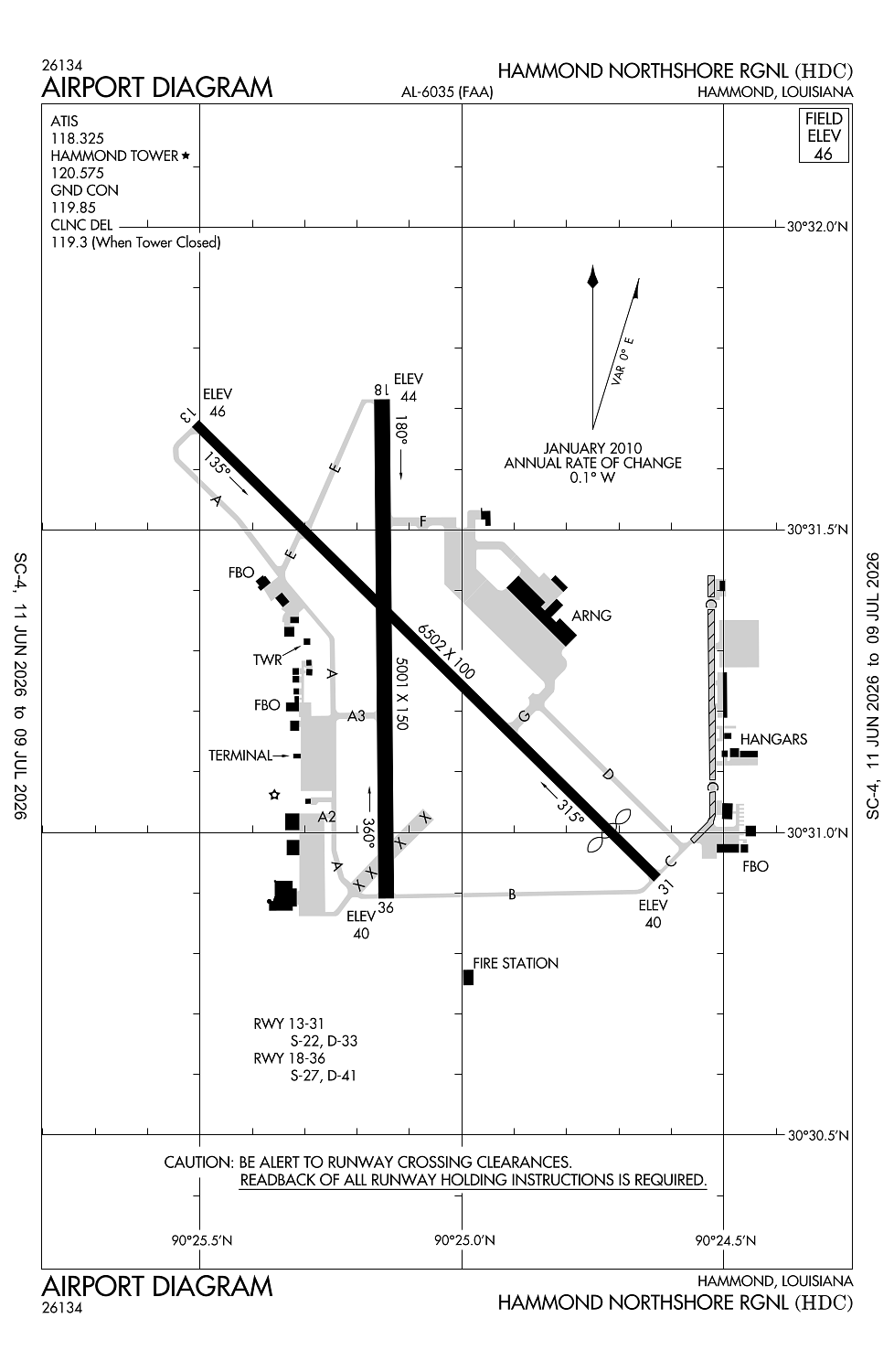
Location:
Hammond, LA
Elevation:
46ft
Sectional:
New Orleans
Activation date:
Nov 1941
Fuel:
100LL, A (prices)
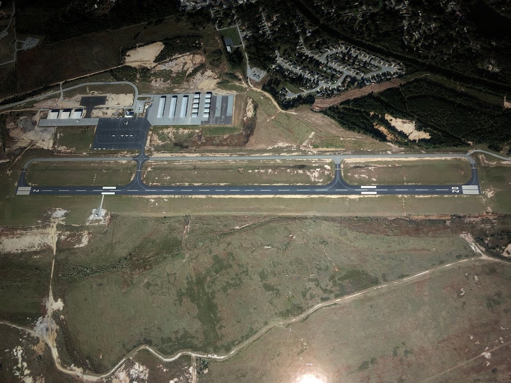
Runway 13/31:
6,502ft
Runway 18/36:
5,001ft
Access: Open to the public
Similar Airports


Current Weather — VFR
-
Weather data is strictly informational and not for flight planning purposes.
-
METAR2026-07-24 12:15:00 CDT
Ceiling: Sky clear Wind: 170° @ 6kt Temperature: 92°F Dewpoint: 69°F Weather: N/A Visbility: 10SM Raw:METAR KHDC 241715Z AUTO 17006KT 10SM CLR 33/21 A3011 RMK AO2 T03340211 -
TAF2026-07-24 13:00:00 CDT – 2026-07-25 13:00:00 CDT
Ceiling: Sky clear Wind: Variable Weather: N/A Visbility: 6SM Clouds: Scattered @ 3,000ft Raw:TAF KHDC 241720Z 2418/2518 VRB05KT P6SM SCT030
Click/tap to add an annotation marker to the map
No webcams added yet.
Remarks
- Birds, deer & coyotes on & invof arpt.
- Mil & govt acft svcd at nw apn at fbo.
- For cd when atct is clsd ctc msy apch at 504-471-4350 or 119.3.
- Caution: twy d unmkd and unlgtd.
- Actvt malsr rwy 18; reil rwy 13, 31, & 36; mirl rwy 13/31 & 18/36; preset low intst dusk-dawn; to incr intst - ctaf.
Comments