Pirep is a free, collaborative database of all public and private airports. All pilots are welcome to contribute their local knowledge to any airport, no registration required.

No upcoming events. Is anything happening here soon?
Last updated: 2024-02-25 01:18:50 EST
Airport Statistics
- Landing & tie-down fees
- Crew car availability
- Transient parking location
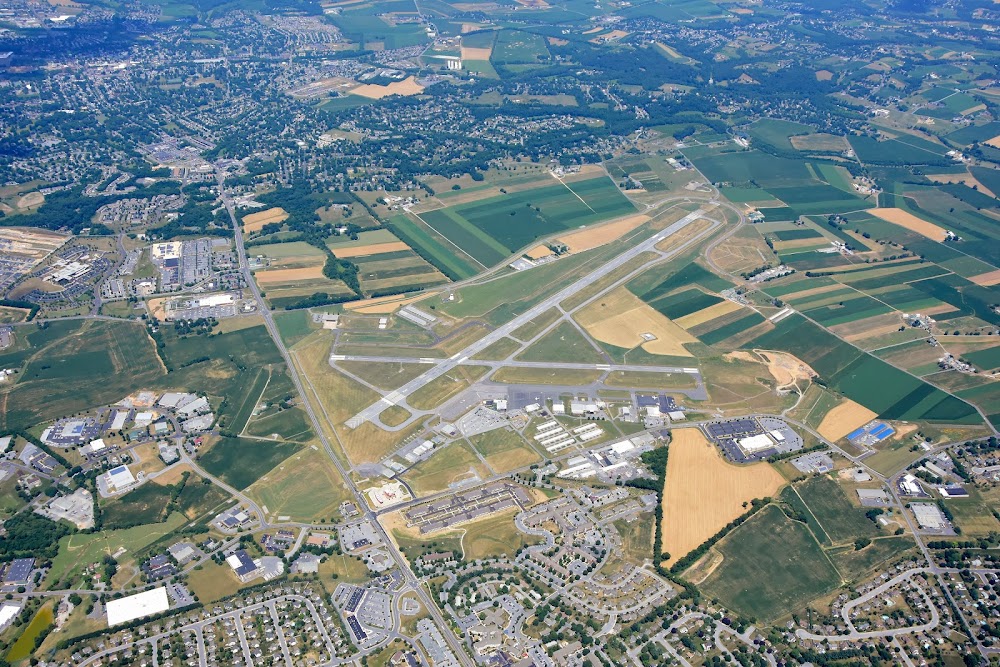
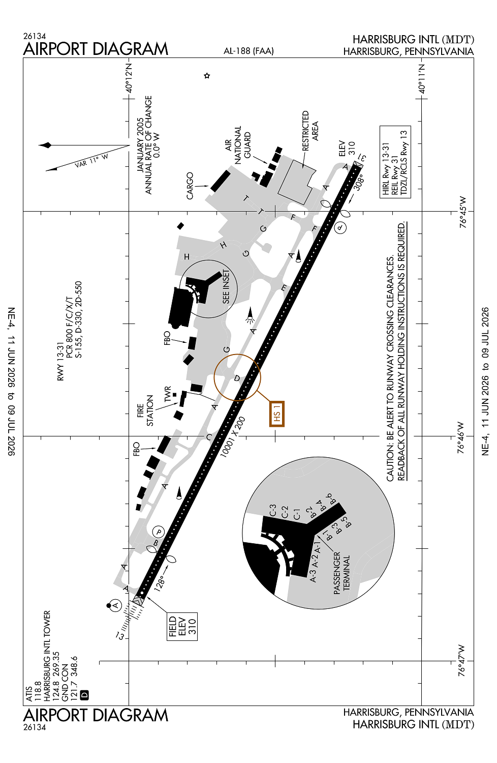
Location:
Harrisburg, PA
Elevation:
310ft
Sectional:
New York
Activation date:
Jul 1942
Fuel:
100LL, A (prices)
Runway 13/31:
10,001ft
Access: Open to the public
Similar Airports
Current Weather — VFR
-
Weather data is strictly informational and not for flight planning purposes.
-
METAR2026-07-14 05:56:00 EDT
Ceiling: Sky clear Wind: Calm Temperature: 69°F Dewpoint: 62°F Weather: N/A Visbility: 10SM Clouds: Few @ 25,000ft Raw:METAR KMDT 140956Z 00000KT 10SM FEW250 21/17 A3014 RMK AO2 SLP204 T02110172 -
TAF2026-07-14 02:00:00 EDT – 2026-07-14 08:00:00 EDT
Ceiling: Sky clear Wind: 220° @ 3kt Weather: N/A Visbility: 6SM Clouds: @ ft Raw:TAF KMDT 140539Z 1406/1506 22003KT P6SM SKC FM141200 26008KT P6SM SKC FM150500 27004KT P6SM FEW250 -
TAF2026-07-14 08:00:00 EDT – 2026-07-15 01:00:00 EDT
Ceiling: Sky clear Wind: 260° @ 8kt Weather: N/A Visbility: 6SM Clouds: @ ft Raw:TAF KMDT 140539Z 1406/1506 22003KT P6SM SKC FM141200 26008KT P6SM SKC FM150500 27004KT P6SM FEW250 -
TAF2026-07-15 01:00:00 EDT – 2026-07-15 02:00:00 EDT
Ceiling: Sky clear Wind: 270° @ 4kt Weather: N/A Visbility: 6SM Clouds: Few @ 25,000ft Raw:TAF KMDT 140539Z 1406/1506 22003KT P6SM SKC FM141200 26008KT P6SM SKC FM150500 27004KT P6SM FEW250
Click/tap to add an annotation marker to the map
No webcams added yet.
Remarks
- Cargo ramp clsd to tsnt acft wo prior permission; call amgr 717-948-3919.
- Bird flocks on & invof arpt.
- No touch & go ldgs 2300-0600 lcl.
- Remarks-ang: acft not supporting ang and all fighter acft must ctc fbo c 717-944-4666 for prk and fuel. nstd mrk on c130j prk apron spot 5; white painted lines denoting laircm laser testing area.
- Acft destined for avflight harrisburg so indicate in rmk sec of dd175 and attempt to ctc with eta on 122.95, 15 min prior to lnd.
Comments