Pirep is a free, collaborative database of all public and private airports. All pilots are welcome to contribute their local knowledge to any airport, no registration required.


No upcoming events. Is anything happening here soon?
Last updated: 2023-04-14 13:53:15 EDT
Last updated: 2023-04-14 12:18:27 EDT
Last updated: 2023-04-14 06:18:44 EDT
Last updated: 2023-04-14 06:18:44 EDT
Last updated: 2023-04-14 06:18:44 EDT
Last updated: 2023-04-14 06:18:44 EDT
Airport Statistics
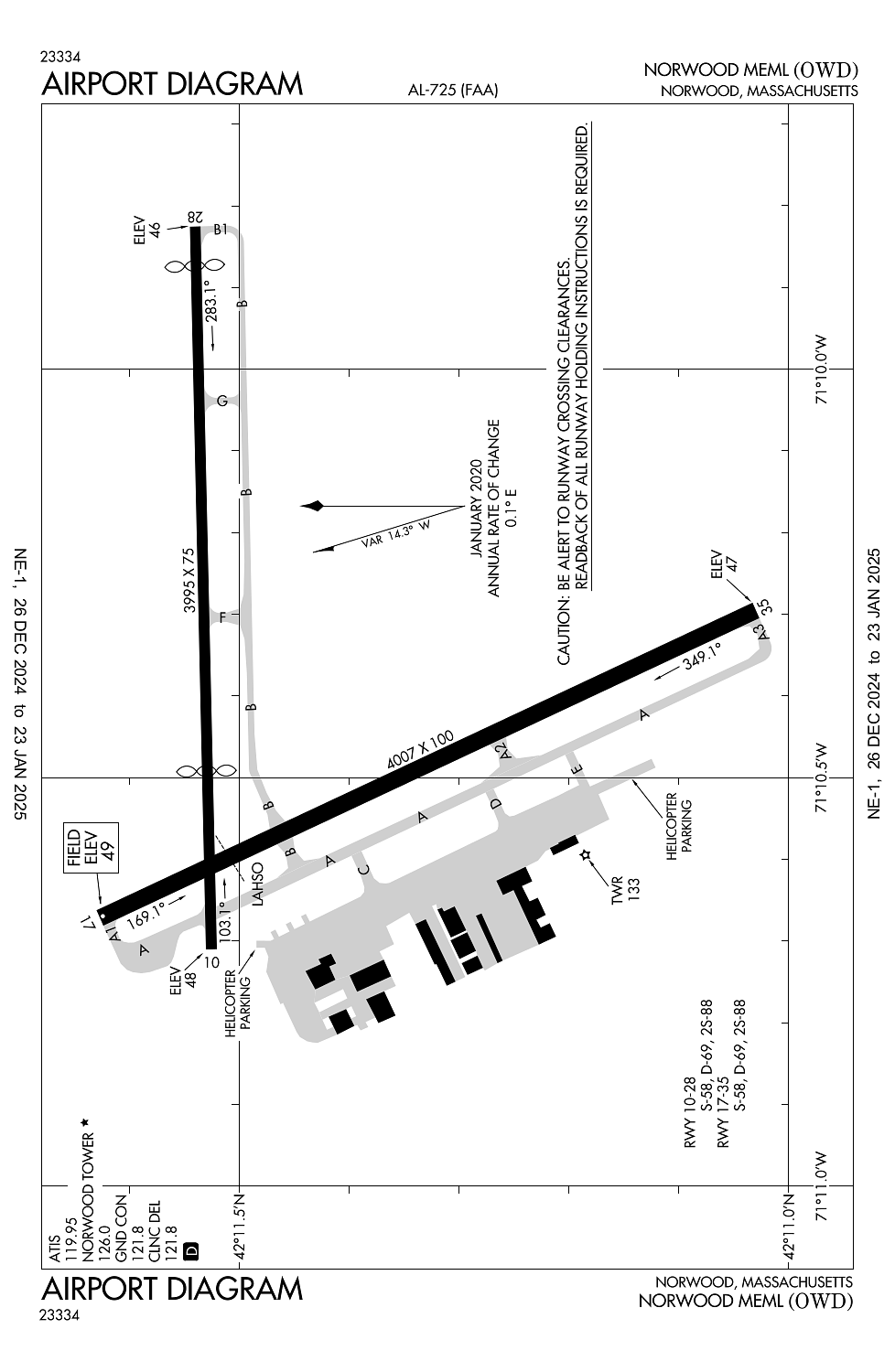
Location:
Norwood, MA
Elevation:
49ft
Sectional:
New York
Activation date:
Mar 1943
Fuel:
100LL, A, A+ (prices)
Runway 17/35:
4,007ft
Runway 10/28:
3,995ft
Access: Open to the public
Similar Airports

Current Weather — VFR
-
Weather data is strictly informational and not for flight planning purposes.
-
METAR2025-01-21 01:53:00 EST
Ceiling: Sky clear Wind: Calm Temperature: 5°F Dewpoint: 0°F Weather: N/A Visbility: 10SM Raw:KOWD 210653Z AUTO 00000KT 10SM CLR M15/M18 A3047 RMK AO2 SLP318 I1000 T11501183 $
Click/tap to add an annotation marker to the map
No webcams added yet.
Remarks
- Filed for record purposes only.
- 1199 ft /1349 ft msl/ and 1249 ft /1349 ft msl/ tv twr 8 nm nnw. 1063.5 ft /1184 ft msl/ twr 8.5 nm nnw.
- All acft exceeding 87 eff perceived noise level in dbs or 75 dbs, as measured in part 36 prohibited fm using arpt.
- 125 ft flagpole 1 mi nw of rwy 17 apch.
- Gate 2 txl ltd to acft with wingspans of 50 ft or less. gate 3 txl ltd to acft with wingspans of 45 ft or less.
Comments