Pirep is a free, collaborative database of all public and private airports. All pilots are welcome to contribute their local knowledge to any airport, no registration required.


No upcoming events. Is anything happening here soon?
Last updated: 2023-06-13 23:35:34 EDT
Airport Statistics
- Local flying clubs
- WiFi availability
- Fuel pump location
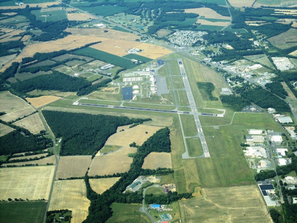
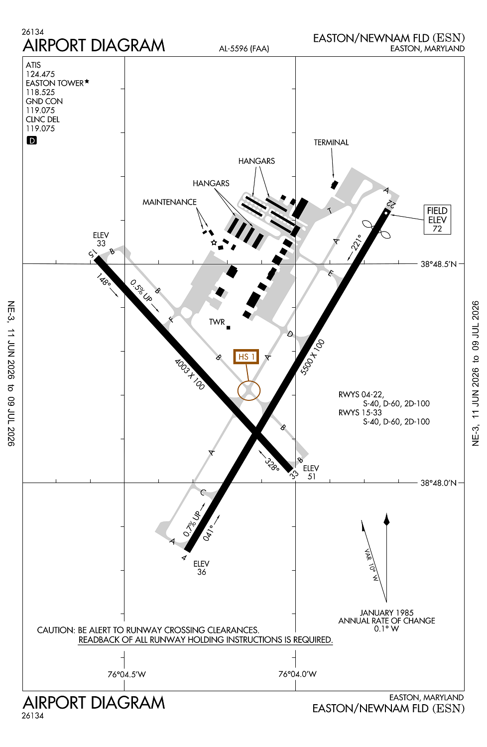
Location:
Easton, MD
Elevation:
72ft
Sectional:
Washington
Activation date:
Feb 1944
Fuel:
100LL, A (prices)
Runway 04/22:
5,500ft
Runway 15/33:
4,003ft
Access: Open to the public
Similar Airports

Current Weather — MVFR
-
Weather data is strictly informational and not for flight planning purposes.
-
METAR2026-07-21 10:45:00 EDT
Ceiling: 1,500ft Wind: 220° @ 10kt, gusts 16kt Temperature: 78°F Dewpoint: 75°F Weather: N/A Visbility: 9SM Clouds: Overcast @ 1,500ft Raw:METAR KESN 211445Z 22010G16KT 9SM OVC015 26/24 A2983
Click/tap to add an annotation marker to the map
No webcams added yet.
Remarks
- This airport has been surveyed by the national geodetic survey.
- Existed prior to 1959.
- Deer, birds, other wildlife on & invof arpt.
- Rwy 15/33 distance markers every 1000 ft west side rwy.
- For cd when atct is clsd ctc potomac apch at 866-429-5882.
Comments