Pirep is a free, collaborative database of all public and private airports. All pilots are welcome to contribute their local knowledge to any airport, no registration required.
Upcoming Events
-
Sat, Aug 1 2026 9:00am – 10:30am
Repeats every month on the first Saturday- Event webpage: https://teamup.com/event/show/id/bp6tZ1Ux6ZtXzLrNoSsEa77MFfifjv
- Host: Bremerton Pilots Association
-
Wed, Aug 12 2026 6:30pm – 8:30pm
Repeats every month on the second Wednesday- Event webpage: https://teamup.com/event/show/id/JVTTVNgQ7ukgdURRMbvo4GdHfhvMkd
- Host: Bremerton EAA Chapter 406
Last updated: 2023-03-27 11:58:30 PDT
Last updated: 2024-02-23 21:58:07 PST
Last updated: 2024-03-08 19:07:01 PST
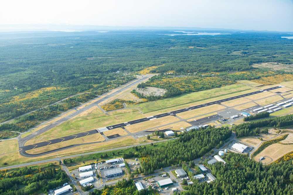
Airport Statistics
Location:
Bremerton, WA
Elevation:
444ft
Sectional:
Seattle
Activation date:
Dec 1938
Fuel:
100LL, A (prices)
Runway 02/20:
6,000ft
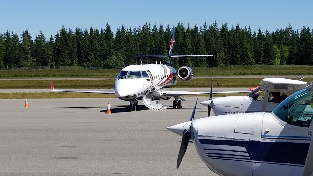
Access: Open to the public
Similar Airports
Current Weather — VFR
-
Weather data is strictly informational and not for flight planning purposes.
-
METAR2026-07-20 20:56:00 PDT
Ceiling: Sky clear Wind: Calm Temperature: 73°F Dewpoint: 60°F Weather: N/A Visbility: 10SM Raw:METAR KPWT 210356Z AUTO 00000KT 10SM CLR 23/16 A2995 RMK AO2 SLP142 T02330156 -
TAF2026-07-20 17:00:00 PDT – 2026-07-21 02:00:00 PDT
Ceiling: 25,000ft Wind: Variable Weather: N/A Visbility: 6SM Clouds: Broken @ 25,000ft Raw:TAF KPWT 202320Z 2100/2124 VRB05KT P6SM BKN250 FM210900 00000KT P6SM BKN200 FM211700 05004KT P6SM SCT200 FM212100 05004KT P6SM SCT200 -
TAF2026-07-21 02:00:00 PDT – 2026-07-21 10:00:00 PDT
Ceiling: 20,000ft Wind: Calm Weather: N/A Visbility: 6SM Clouds: Broken @ 20,000ft Raw:TAF KPWT 202320Z 2100/2124 VRB05KT P6SM BKN250 FM210900 00000KT P6SM BKN200 FM211700 05004KT P6SM SCT200 FM212100 05004KT P6SM SCT200 -
TAF2026-07-21 10:00:00 PDT – 2026-07-21 14:00:00 PDT
Ceiling: Sky clear Wind: 050° @ 4kt Weather: N/A Visbility: 6SM Clouds: Scattered @ 20,000ft Raw:TAF KPWT 202320Z 2100/2124 VRB05KT P6SM BKN250 FM210900 00000KT P6SM BKN200 FM211700 05004KT P6SM SCT200 FM212100 05004KT P6SM SCT200 -
TAF2026-07-21 14:00:00 PDT – 2026-07-21 17:00:00 PDT
Ceiling: Sky clear Wind: 050° @ 4kt Weather: N/A Visbility: 6SM Clouds: Scattered @ 20,000ft Raw:TAF KPWT 202320Z 2100/2124 VRB05KT P6SM BKN250 FM210900 00000KT P6SM BKN200 FM211700 05004KT P6SM SCT200 FM212100 05004KT P6SM SCT200
Click/tap to add an annotation marker to the map


Remarks
- This airport has been surveyed by the national geodetic survey.
- Estabd prior to 1959.
- Fence crosses n end of abnd rwy.
- For cd ctc seattle apch at 206-214-4723.
- Winter weather ops and reporting mon - fri 8:00-16:30.
- Actvt malsr rwy 20; reil rwy 02; papi rwy 02; hirl 02/20; twy lgts - ctaf. papi rwy 20 opr consly.
- Pilot must prvd tiedowns.
- 24 hr fuel trml 300 ft wsw of twy a4, only for 100ll.
Comments