Pirep is a free, collaborative database of all public and private airports. All pilots are welcome to contribute their local knowledge to any airport, no registration required.


No upcoming events. Is anything happening here soon?
Last updated: 2024-03-15 02:55:13 EDT
Airport Statistics
- Landing & tie-down fees
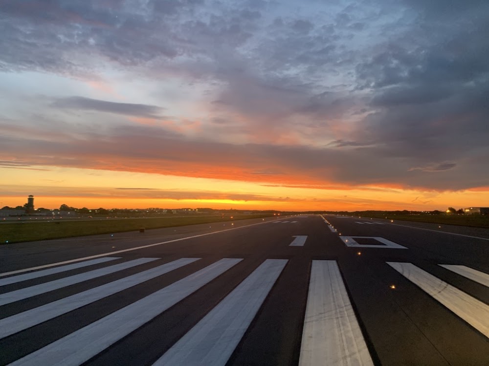
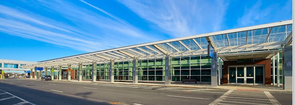
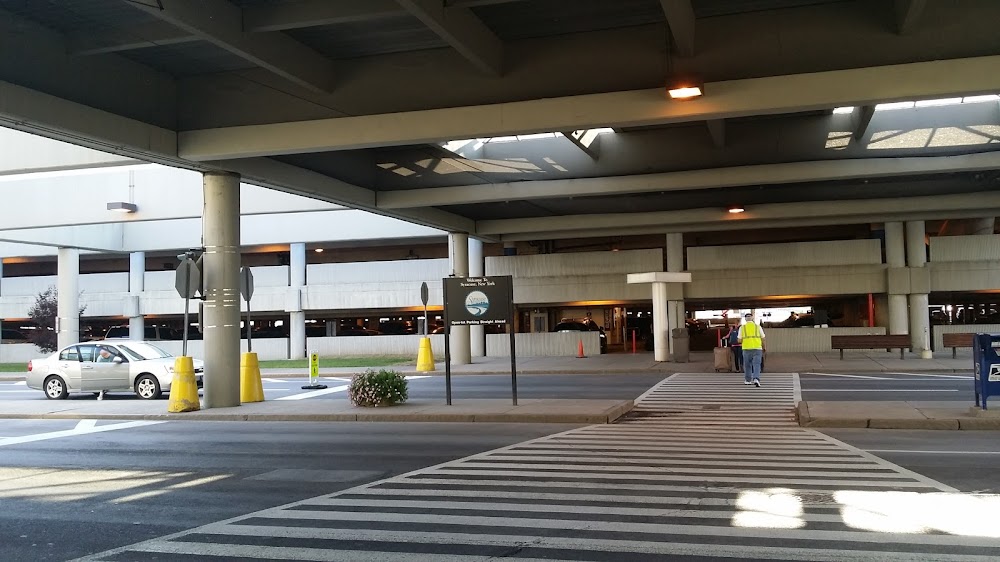
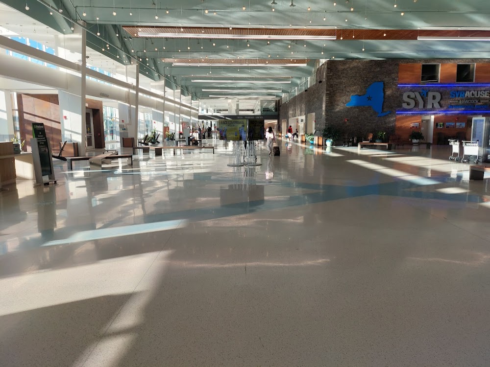
- Airport photos
- WiFi availability
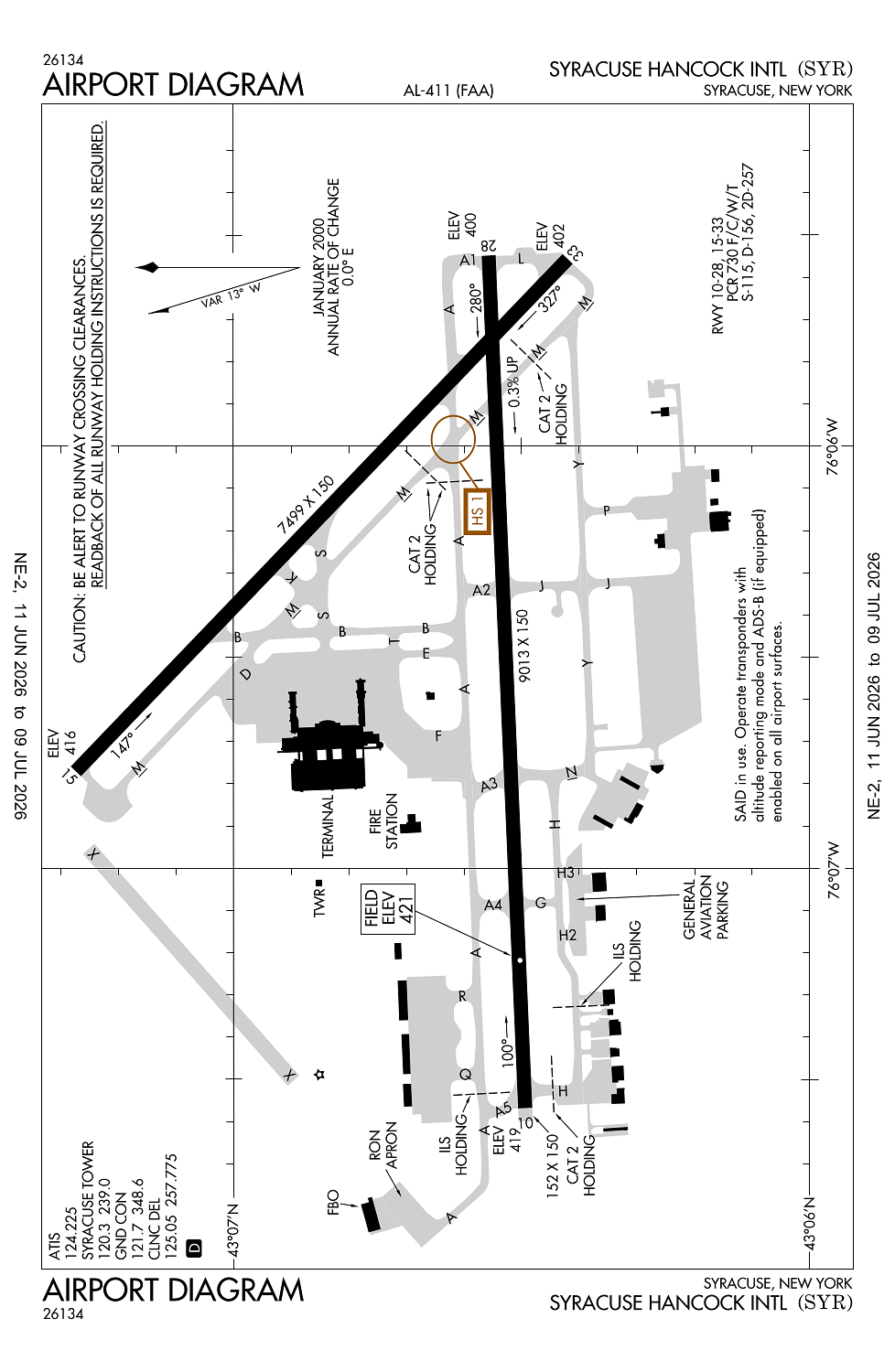
Location:
Syracuse, NY
Elevation:
421ft
Sectional:
New York
Activation date:
Aug 1943
Fuel:
100LL, A (prices)
Runway 10/28:
9,013ft
Runway 15/33:
7,499ft
Access: Open to the public
Similar Airports
Current Weather — VFR
-
Weather data is strictly informational and not for flight planning purposes.
-
METAR2026-07-28 21:54:00 EDT
Ceiling: 6,000ft Wind: Calm Temperature: 69°F Dewpoint: 66°F Weather: N/A Visbility: 10SM Clouds: Scattered @ 4,200ft, Broken @ 6,000ft, Broken @ 8,000ft Raw:METAR KSYR 290154Z 00000KT 10SM SCT042 BKN060 BKN080 21/19 A2963 RMK AO2 SLP028 T02110194 -
TAF2026-07-28 20:00:00 EDT – 2026-07-29 00:00:00 EDT
Ceiling: 4,000ft Wind: Variable Weather: Showers in vicinity Visbility: 6SM Clouds: Scattered @ 2,500ft, Overcast @ 4,000ft Raw:TAF KSYR 282354Z 2900/2924 VRB04KT P6SM VCSH SCT025 OVC040 TEMPO 2900/2904 BKN025 FM290400 28004KT 6SM BR OVC025 TEMPO 2904/2907 OVC015 FM290700 28004KT 6SM BR OVC015 FM291500 31008KT 6SM -SHRA BR OVC020 -
TAF2026-07-28 20:00:00 EDT – 2026-07-29 00:00:00 EDT
Ceiling: 2,500ft Wind: 000° @ kt Weather: N/A Visbility: SM Clouds: Broken @ 2,500ft Raw:TAF KSYR 282354Z 2900/2924 VRB04KT P6SM VCSH SCT025 OVC040 TEMPO 2900/2904 BKN025 FM290400 28004KT 6SM BR OVC025 TEMPO 2904/2907 OVC015 FM290700 28004KT 6SM BR OVC015 FM291500 31008KT 6SM -SHRA BR OVC020 -
TAF2026-07-29 00:00:00 EDT – 2026-07-29 03:00:00 EDT
Ceiling: 2,500ft Wind: 280° @ 4kt Weather: Mist Visbility: 6SM Clouds: Overcast @ 2,500ft Raw:TAF KSYR 282354Z 2900/2924 VRB04KT P6SM VCSH SCT025 OVC040 TEMPO 2900/2904 BKN025 FM290400 28004KT 6SM BR OVC025 TEMPO 2904/2907 OVC015 FM290700 28004KT 6SM BR OVC015 FM291500 31008KT 6SM -SHRA BR OVC020 -
TAF2026-07-29 00:00:00 EDT – 2026-07-29 03:00:00 EDT
Ceiling: 1,500ft Wind: 000° @ kt Weather: N/A Visbility: SM Clouds: Overcast @ 1,500ft Raw:TAF KSYR 282354Z 2900/2924 VRB04KT P6SM VCSH SCT025 OVC040 TEMPO 2900/2904 BKN025 FM290400 28004KT 6SM BR OVC025 TEMPO 2904/2907 OVC015 FM290700 28004KT 6SM BR OVC015 FM291500 31008KT 6SM -SHRA BR OVC020 -
TAF2026-07-29 03:00:00 EDT – 2026-07-29 11:00:00 EDT
Ceiling: 1,500ft Wind: 280° @ 4kt Weather: Mist Visbility: 6SM Clouds: Overcast @ 1,500ft Raw:TAF KSYR 282354Z 2900/2924 VRB04KT P6SM VCSH SCT025 OVC040 TEMPO 2900/2904 BKN025 FM290400 28004KT 6SM BR OVC025 TEMPO 2904/2907 OVC015 FM290700 28004KT 6SM BR OVC015 FM291500 31008KT 6SM -SHRA BR OVC020 -
TAF2026-07-29 11:00:00 EDT – 2026-07-29 20:00:00 EDT
Ceiling: 2,000ft Wind: 310° @ 8kt Weather: Light rain showers, mist Visbility: 6SM Clouds: Overcast @ 2,000ft Raw:TAF KSYR 282354Z 2900/2924 VRB04KT P6SM VCSH SCT025 OVC040 TEMPO 2900/2904 BKN025 FM290400 28004KT 6SM BR OVC025 TEMPO 2904/2907 OVC015 FM290700 28004KT 6SM BR OVC015 FM291500 31008KT 6SM -SHRA BR OVC020
Click/tap to add an annotation marker to the map
No webcams added yet.
Remarks
- No chtr ops thru pax trml bldg wo ppr.
- Noise abatement procs in efct.
- Deer/coyote/birds on & invof arpt.
- No jet eng maint runs abv idle btwn 2300-0600.
- No tsnt acft prkg on main trml ramp.
Comments