Pirep is a free, collaborative database of all public and private airports. All pilots are welcome to contribute their local knowledge to any airport, no registration required.


No upcoming events. Is anything happening here soon?
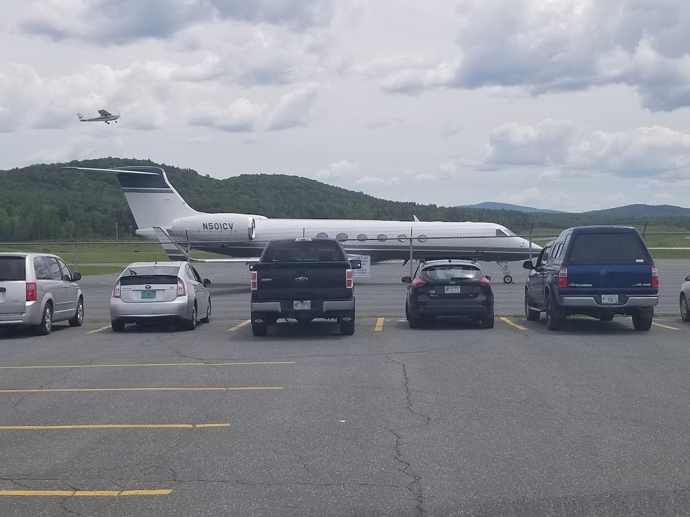
Last updated: 2024-05-17 02:49:08 EDT
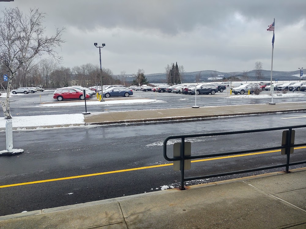
Last updated: 2023-11-13 03:28:24 EST
Airport Statistics
- WiFi availability
- Landing & tie-down fees
- Transient parking location
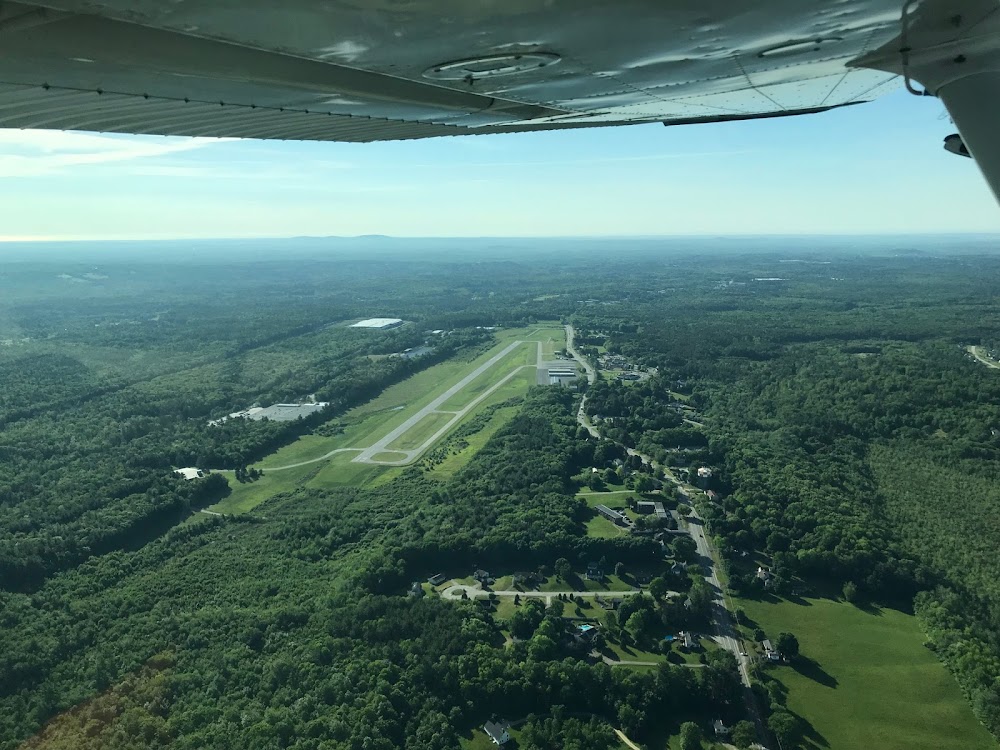
Location:
Lebanon, NH
Elevation:
603ft
Sectional:
New York
Activation date:
Nov 1946
Fuel:
100LL, A (prices)
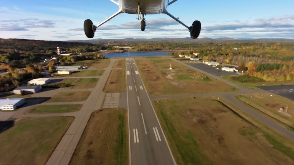
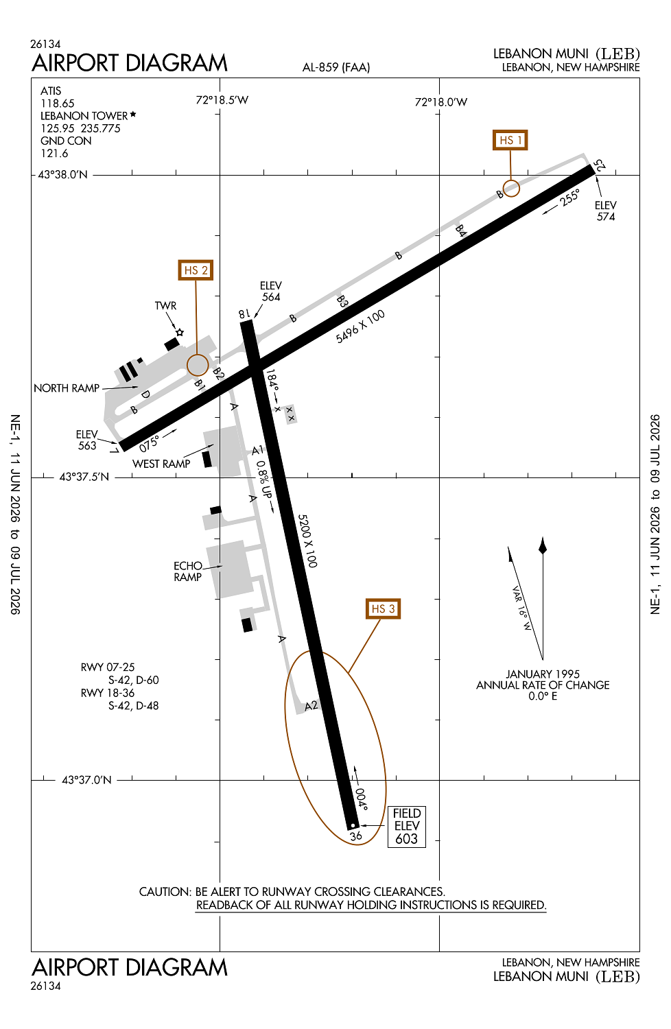
Runway 07/25:
5,496ft
Runway 18/36:
5,200ft
Access: Open to the public
Similar Airports
Current Weather — MVFR
-
Weather data is strictly informational and not for flight planning purposes.
-
METAR2026-07-29 09:53:00 EDT
Ceiling: 2,100ft Wind: Calm Temperature: 69°F Dewpoint: 66°F Weather: N/A Visbility: 10SM Clouds: Broken @ 2,100ft, Broken @ 2,700ft Raw:METAR KLEB 291353Z 00000KT 10SM BKN021 BKN027 21/19 A2970 RMK AO2 SLP049 T02110189 -
TAF2026-07-29 08:00:00 EDT – 2026-07-29 12:00:00 EDT
Ceiling: 1,800ft Wind: Variable Weather: Mist Visbility: 5SM Clouds: Broken @ 1,800ft, Broken @ 2,300ft, Overcast @ 6,000ft Raw:TAF KLEB 291120Z 2912/3012 VRB03KT 5SM BR BKN018 BKN023 OVC060 FM291600 09006KT P6SM -RA OVC015 FM300100 03006KT 4SM -RA BR OVC015 FM300500 02003KT 2SM -RA BR OVC007 -
TAF2026-07-29 12:00:00 EDT – 2026-07-29 21:00:00 EDT
Ceiling: 1,500ft Wind: 090° @ 6kt Weather: Light rain Visbility: 6SM Clouds: Overcast @ 1,500ft Raw:TAF KLEB 291120Z 2912/3012 VRB03KT 5SM BR BKN018 BKN023 OVC060 FM291600 09006KT P6SM -RA OVC015 FM300100 03006KT 4SM -RA BR OVC015 FM300500 02003KT 2SM -RA BR OVC007 -
TAF2026-07-29 21:00:00 EDT – 2026-07-30 01:00:00 EDT
Ceiling: 1,500ft Wind: 030° @ 6kt Weather: Light rain, mist Visbility: 4SM Clouds: Overcast @ 1,500ft Raw:TAF KLEB 291120Z 2912/3012 VRB03KT 5SM BR BKN018 BKN023 OVC060 FM291600 09006KT P6SM -RA OVC015 FM300100 03006KT 4SM -RA BR OVC015 FM300500 02003KT 2SM -RA BR OVC007 -
TAF2026-07-30 01:00:00 EDT – 2026-07-30 08:00:00 EDT
Ceiling: 700ft Wind: 020° @ 3kt Weather: Light rain, mist Visbility: 2SM Clouds: Overcast @ 700ft Raw:TAF KLEB 291120Z 2912/3012 VRB03KT 5SM BR BKN018 BKN023 OVC060 FM291600 09006KT P6SM -RA OVC015 FM300100 03006KT 4SM -RA BR OVC015 FM300500 02003KT 2SM -RA BR OVC007
Click/tap to add an annotation marker to the map
No webcams added yet.
Remarks
- This airport has been surveyed by the national geodetic survey.
- Estab prior to 1959.
- Trees 5600 ft e of arpt, elev 1253 ft; trees 6700 ft e of arpt, elev 1275 ft; trees indcd are obstn lgtd.
- Ocnl wildlife act on & nr arpt.
- Hang gldr ops invof mt ascutney, vt 20 mi sw leb sfc-8000 ft days.
Comments